Shift Geophysics mission is to deliver high‑quality geophysical data that supports informed decision‑making, driving discovery and confidence in resource and geotechnical development.
We achieve this through:
Shift Geophysics acquires the highest quality geophysical data possible by utilising the worlds most advanced drone magnetometer bird;
An integrated inertial measurement unit enables Shift Geophysics data processors—bringing over 80 years of combined experience to accurately compensate the data, reducing residual noise to a fraction of what most competitors deliver.
The value of drone magnetic surveys over manned airborne systems lies in their exceptionally high resolution and ability to map geological structure at a level not achievable by other methods—particularly in complex terrain or at low altitude.
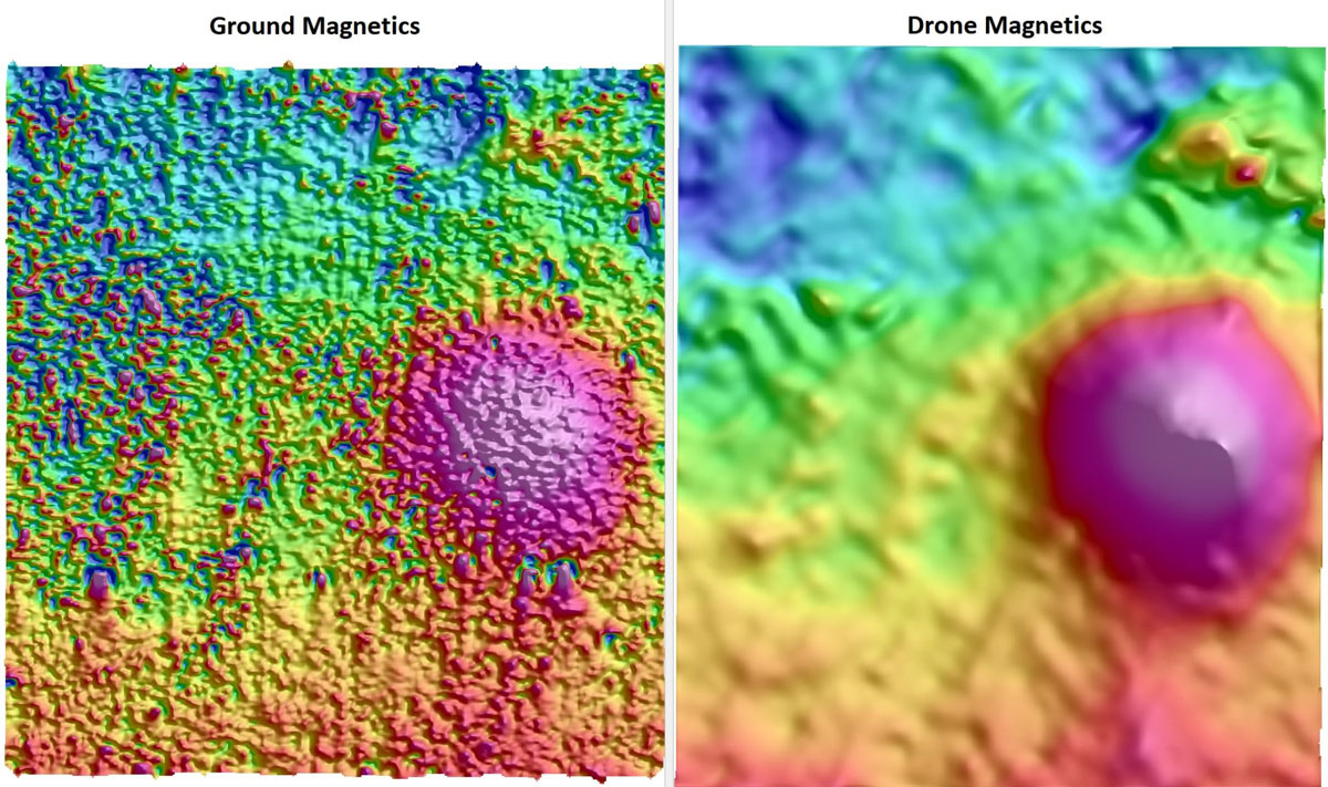
Shift Geophysics selects and modifies drones specifically to meet the demands of geophysical surveying, with:
Coupled with Starlink connectivity, Shift Geophysics drones can accurately drape terrain across large, remote, and logistically challenging areas—anywhere in the world.